Missions & Projects
For further mission information, data, research, and other resources, see Biospheric Sciences Projects.
Featured
Alphabetical
By Last Name:
Displaying records 1 to 24 of 26.
Show:
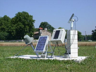
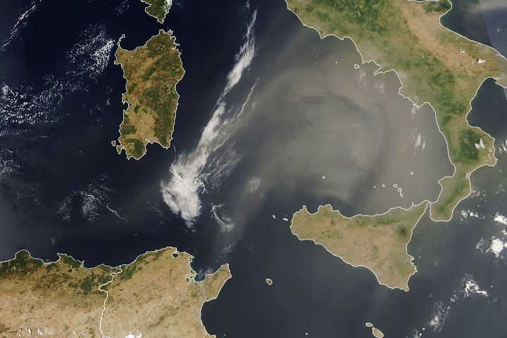
AErosol RObotic NETwork (AERONET)
The AERONET (AErosol RObotic NETwork) program is a federation of ground-based remote sensing aerosol networks established by NASA and PHOTONS (PHOtométrie pour le Traitement Opérationnel de Normalisation Satellitaire; Univ. of Lille 1, CNES, and CNRS-INSU) and is greatly expanded by networks (e.g., RIMA, AeroSpan, AEROCAN, and CARSNET) and collaborators from national agencies, institutes, universities, individual scientists, and partners. The program provides a long-term, continuous and readily accessible public domain database of aerosol optical, microphysical and radiative properties for aerosol research and characterization, validation of satellite retrievals, and synergism with other databases. The network imposes standardization of instruments, calibration, processing and distribution.
Airborne Validation Unified Experiment: Land to Ocean (AVUELO)
The Airborne Validation Unified Experiment: Land to Ocean (AVUELO) is a partnership between NASA, the Smithsonian Institution’s Tropical Research Institute, and the Costa Rican Fisheries Federation, as well as universities and institutes in the United States and Panama. AVUELO’s goal is to calibrate a new class of space-borne imagers for tropical vegetation and oceans research.
Applied Sciences
Connecting NASA researchers with interagency activities and partnerships to facilitate practical and innovative uses of Earth observations for societal benefit in six thematic areas: Air Quality and Health, Chesapeake Bay, Climate and Environmental Health, Disasters, Food Security, and Mission Applications.

Arctic- Boreal Vulnerability Experiment (ABoVE)
Climate change in the Arctic and Boreal region is unfolding faster than anywhere else on Earth, resulting in reduced Arctic sea ice, thawing of permafrost soils, decomposition of long- frozen organic matter, widespread changes to lakes, rivers, coastlines, and alterations of ecosystem structure and function. NASA's Terrestrial Ecology Program is conducting a major field campaign, the Arctic-Boreal Vulnerability Experiment (ABoVE), in Alaska and western Canada, for 8 to 10 years, starting in 2015. ABoVE seeks a better understanding of the vulnerability and resilience of ecosystems and society to this changing environment.

Blueflux
BlueFlux is supported by the NASA Carbon Monitoring System to measure fluxes of carbon dioxide and methane emissions over blue carbon ecosystems. The measurements are made using chambers, flux towers and aircraft flux instruments, including the CARbon Flux Experiment (CARAFE) payload. The data products will be used by local stakeholders to support mangrove and sawgrass restoration for carbon sequestration.
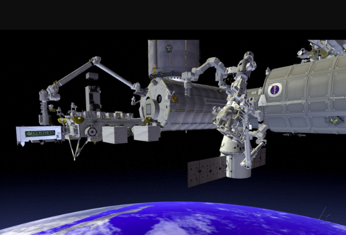
ECOsystem Spaceborne Thermal Radiometer Experiment on Space Station (ECOSTRESS)
The ECOSTRESS mission is accurately measuring the temperature of plants on Earth. Plants regulate their temperature by releasing water through tiny pores on their leaves called stomata. If they have sufficient water they can maintain their temperature, but if there is insufficient water, their temperatures rise and this temperature rise can be measured with ECOSTRESS. The images acquired by ECOSTRESS are the most detailed temperature images of the surface ever acquired from space and can be used to measure the temperature of an individual farmers field.
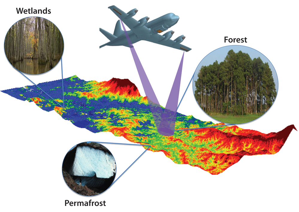
Ecosystems Synthetic Aperture Radar (EcoSAR)
EcoSAR is an advanced airborne polarimetric and interferometric P-band SAR instrument in development at NASA’s Goddard Space Flight Center through NASA’s Earth Science Technology Office Instrument Incubator Program (ESTO IIP).
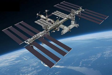
Global Ecosystem Dynamics Investigation (GEDI)
The Global Ecosystem Dynamics Investigation (GEDI) is a laser-based instrument for mapping the 3-D structure of Earth’s forests. Led by the University of Maryland, College Park, and built by Goddard, GEDI was deployed on the International Space Station in 2019, and has provided the first comprehensive, high-resolution measurements of the vertical canopy structure of Earth’s temperate and tropical forests.
Key Staff
- Principal Investigator: RALPH DUBAYAH
- Deputy Principal Investigator: J Blair
- Deputy Principal Investigator:
- Co Investigator:
- Co Investigator: Lola Fatoyinbo
- Co Investigator: Michelle Hofton
- Co Investigator:
- Co Investigator: Scott Luthcke
- Co Investigator:
- Co Investigator:
- Instrument Scientist: J Blair
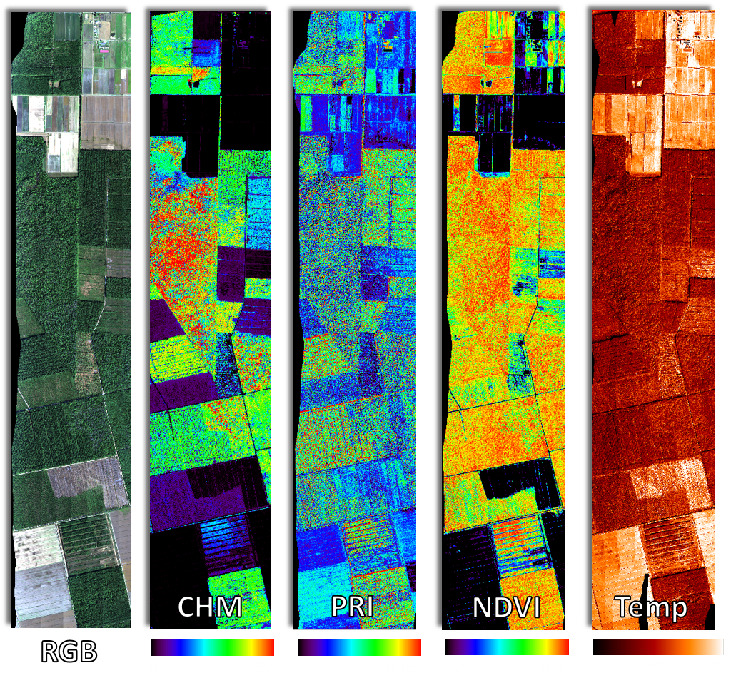
Goddard's LiDAR, Hyperspectral & Thermal Imager (G-LiHT)
G-LiHT enables data fusion studies by providing coincident data in time and space, and provides fine-scale (<1 m) observations over large areas that are needed in many ecosystem studies.
Joint Polar Satellite System (JPSS)
The Joint Polar Satellite System (JPSS) is the Nation's new generation polar-orbiting operational environmental satellite system. JPSS is a collaborative program between the National Oceanic and Atmospheric Administration (NOAA) and its acquisition agent, National Aeronautics and Space Administration (NASA). This interagency effort is the latest generation of U.S. polar-orbiting, non-geosynchronous environmental satellites. (Source: NOAA)
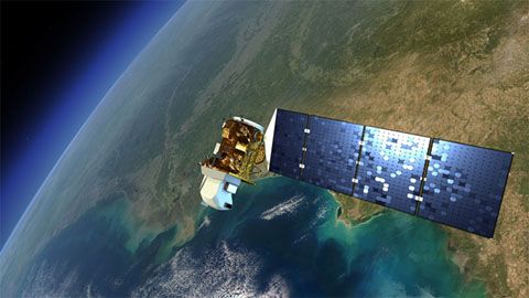
Landsat 8
Launched on February 11, 2013, Landsat 8 (formerly the Landsat Data Continuity Mission, LDCM) is collecting valuable data and imagery used in agriculture, education, business, science, and government.
The Landsat Program provides repetitive acquisition of high resolution multispectral data of the Earth’s surface on a global basis. The data from Landsat spacecraft constitute the longest record of the Earth’s continental surfaces as seen from space. It is a record unmatched in quality, detail, coverage, and value.
Key Staff
- RESEARCH SCIENTIST: Qiang Zhou
- Project Scientist: Christopher Neigh
- Deputy Project Scientist: Bruce Cook
- Instrument Scientist: Philip Dabney
Landsat 9
Landsat 9, a joint NASA and U.S. Geological Survey satellite mission, launched on September 27, 2021, from Vandenberg Space Force Base in California, and will extend the Earth-observing program’s record of land images to half a century.
The Landsat program has provided accurate measurements of Earth’s land cover since 1972. With data from Landsat satellites, ecologists have tracked deforestation in South America, water managers have monitored irrigation of farmland in the American West, and researchers have watched the growth of cities worldwide. With the help of the program’s open archive, firefighters have assessed the severity of wildfires and scientists have mapped the retreat of mountain glaciers.
Key Staff
- Standing Review Board Member: Compton Tucker
- TIRS-2 Deputy Instrument Scientist: Joel McCorkel
- Project Scientist: Christopher Neigh
- Deputy Project Scientist: Bruce Cook
- Instrument Scientist: Philip Dabney
- Calibration & Validation Manager: Kurtis Thome
Instruments
Modeling surface reflectance from VHR imagery (SR VHR)
A model of top-of-atmosphere reflectance (TOAVHR) and Landsat-derived reference (SRreference) provides an high resolution estimate of surface reflectance in VHR imagery (SRVHR). Batch production of these SRVHR estimates help identify the most similar datasets useful for large area analysis.

Moderate Resolution Imaging Spectroradiometer (MODIS)
MODIS (or Moderate Resolution Imaging Spectroradiometer) is a key instrument aboard the Terra (originally known as EOS AM-1) and Aqua (originally known as EOS PM-1) satellites. Terra's orbit around the Earth is timed so that it passes from north to south across the equator in the morning, while Aqua passes south to north over the equator in the afternoon. Terra MODIS and Aqua MODIS are viewing the entire Earth's surface every 1 to 2 days, acquiring data in 36 spectral bands, or groups of wavelengths (see MODIS Technical Specifications). These data will improve our understanding of global dynamics and processes occurring on the land, in the oceans, and in the lower atmosphere. MODIS is playing a vital role in the development of validated, global, interactive Earth system models able to predict global change accurately enough to assist policy makers in making sound decisions concerning the protection of our environment.
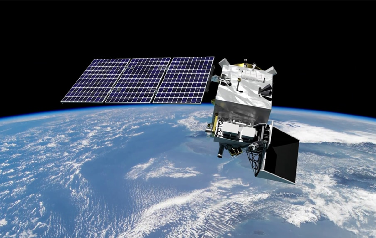
NASA-ISRO SAR Mission (NISAR)
The NASA-ISRO Synthetic Aperture Radar (NISAR) mission is designed to provide a detailed view of the Earth to observe and measure some of the planet's most complex processes, including ecosystem disturbances, ice-sheet collapse, natural hazards, sea level rise, and groundwater issues. Its radar, the first of its kind in space, will systematically map Earth, measuring changes of our planet’s surface as small as a centimeter.

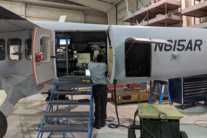
PACE Postlaunch Airborne eXperiment (PACE-PAX)
PACE-PAX is a field campaign to support validation of PACE data products following launch. Validation requires a strategy of varied and extensive measurements, as discussed in the PACE Science Data Product Validation Plan. PACE-PAX is one component of the PACE validation plan, specifically addressing validation of new data products. Because these products are often the result of multi-parameter retrieval algorithms, focused and extensive measurements will be made as part of a dedicated field campaign. This campaign will use a robust suite of instruments deployed on aircraft, which will fly in coordination with ground and ocean-based observations and the PACE satellite overpass. It will be conducted roughly six months following the launch of PACE.
Key Staff
- Principal Investigator: Kirk Knobelspiesse
- Deputy Project Scientist: Ivona Cetinic
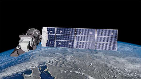
Plankton, Aerosol, Cloud, ocean Ecosystem (PACE)
PACE is NASA's Plankton, Aerosol, Cloud, ocean Ecosystem mission. It launched on February 8, 2024, extending and improving NASA's over 20-year record of satellite observations of global ocean biology, aerosols (tiny particles suspended in the atmosphere), and clouds.
Key Staff
- Ocean Color Atmospheric Correction Lead: Amir Ibrahim
- Science Data Segment Manager: Bryan Franz
- Science Data Segment Deputy Manager: Sean Bailey
- Polarimeter Lead: Kirk Knobelspiesse
- Project Scientist: Jeremy Werdell
- Deputy Project Scientist: Antonio Mannino
- Deputy Project Scientist: Brian Cairns
- Instrument Scientist: Gerhard Meister
- Senior Scientist: Ivona Cetinic
- Senior Scientist: Violeta Sanjuan Calzado
- Senior Scientist: Susanne Craig
SatVision-TOA Geospatial Foundation Model (SatVision-TOA)
SatVision-TOA demonstrates the untapped potential of leveraging moderate- to coarse-resolution data for deep learning in Earth observation. By training a 3-billion-parameter vision transformer on a 100-million-image MODIS TOA dataset, it establishes a scalable, open-source foundation for advancing atmospheric science, cloud analysis, and Earth system modeling. Its released weights and workflows aim to broaden participation and foster collaboration in remote sensing applications. SatVision-TOA captures diverse atmospheric and surface conditions. Additionally, the model improves performance in 3D cloud retrieval and environmental monitoring, surpassing baseline methods.

Snow Water Equivalent SAR and Radiometer (SWESARR)
The Snow Water Equivalent Synthetic Aperture Radar and Radiometer (SWESARR) is a new instrument designed to measure the water content in a snowpack. The instrument, developed at NASA’s Goddard Space Flight Center, uses active and passive microwave sensors to map the radio frequency emissions of the snowpack, which can then be turned into a measurement of snow water equivalent.
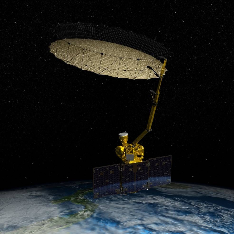
Soil Moisture Active-Passive Mission (SMAP)
The Soil Moisture Active Passive (SMAP) mission is an orbiting observatory that measures the amount of water in the surface soil everywhere on Earth. It was launched in January 2015 and started operation in April 2015. The SMAP radiometer has been operating flawlessly. The radar instrument, ceasing operation in early 2015 due to failure of radar power supply, collected close to 3 months of science data. The prime mission phase of three years was completed in 2018, and since then SMAP has been in extended operation phase.
Key Staff
- Science Team Member: Rolf Reichle
- Calibration Team Member: Emmanuel Dinnat
- Science Team Member: Sujay Kumar
- Deputy Project Scientist: Rajat Bindlish